
Holland
 North Holland has a surprising beauty. It is an empty countryside with small villages and a lot of sheep. Shops and cafes are few and far between, as is overnight accommodation. That said, we did find accommodation each night but there was a degree of planning on the road in looking to find sizeable places where accommodation may exist. This did not work every time and we sometimes had to travel a few miles off the track to find somewhere.
 English was widely spoken and everyone was pleased to be able to help.
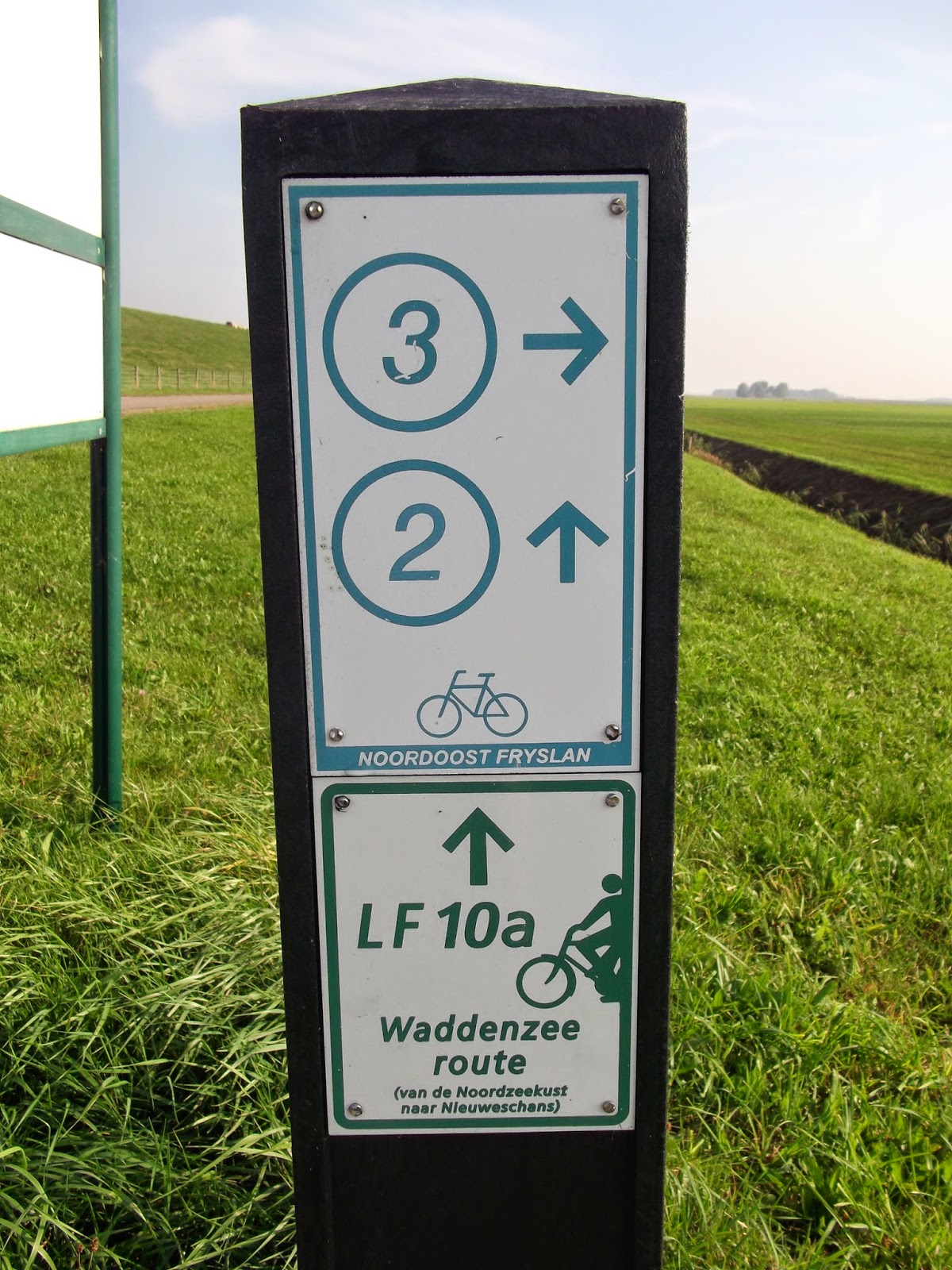
Signage along the route (signed as LF10) was clear and reliable. The Dutch signs are also signed as LF10a and LF10b so that direction of travel could not become confused.
Most of the route was away from busy roads. Much of the ride was on cycle paths and the riding surface was always in excellent condition.
Germany
 Germany we also found full of beauty but it was far busier than North Holland. We expected the cost of accommodation to be more expensive than in Holland but in the event this proved not to be the case - with the very notable exception of Hamburg which was very expensive.
 Again many people spoke some English although not as many as in Holland. We found people to be very welcoming as it seems that English visitors are few and far between.
Signage was poor compared to Holland. Indicators for the NSCR were suspended below other signposts on metal plates that were about the size of a beer mat. It would have been difficult if not impossible to navigate simply by following the signs.
Equipment
We took no special equipment but I had invested in a Garmin Edge Touring and had found some downloadable maps of the route. The Garmin proved very reliable and saved us lots of time checking where we were and looking for signposts. The Holland part of the route appeared on the Garmin as one route and I suspect that it had been assembled from the maps of the route it was that accurate. The German routes followed someone's actual ride. Clearly they had got lost a couple of times and the routes tended to start and finish where the riders had stopped. This led us a few miles off course one day.
No comments:
Post a Comment